Urban & Regional Planning · San Marcos, Texas

Planning from the ground up.

A bilingual planning student who came to the field from the job site: six years of residential foundation projects, board secretary for a rural water supply corporation, and a B.S. in Geography with an Urban and Regional Planning focus at Texas State.

Degree
B.S. Geography, Urban & Regional Planning
Minor
Sociology
Graduation
Expected December 2026
Languages
English and Spanish

Attending the APA Texas Chapter Conference, Irving, October 14–16, 2026.

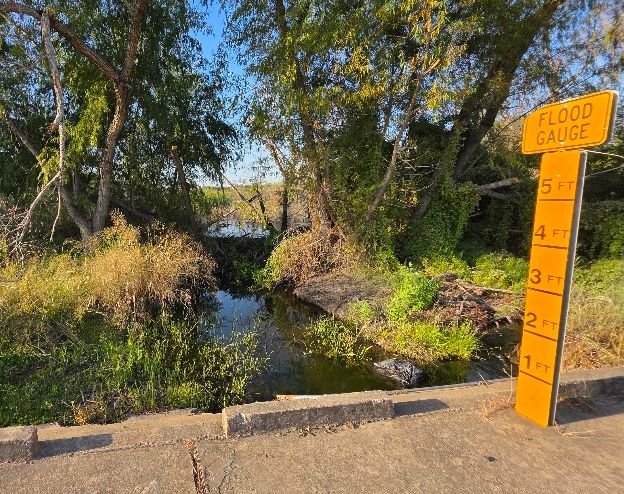
Flood gauge beside an overgrown drainage channel in the Redwood area.
Field review, Redwood & Rancho Vista · Guadalupe County, Texas

Selected work

Field reviews, memos, GIS research and site models. Each sheet lists where the work happened, who it was for, the role, and the references and files behind it.

Home ground: Redwood & Rancho Vista

Redwood Vista Water Supply Corporation
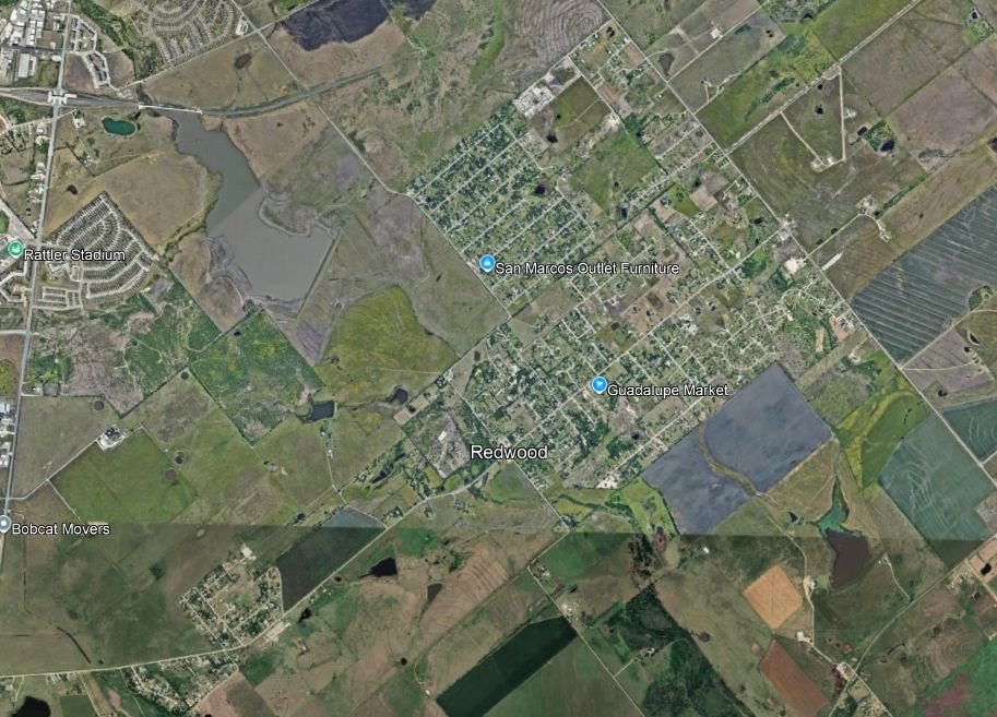
Aerial view of the Redwood and Rancho Vista neighborhoods with surrounding farmland east of San Marcos.
Redwood and Rancho Vista, east of San Marcos in Guadalupe County. Imagery © Google.

A member-owned nonprofit water board formed to bring wastewater and clean water service to Redwood and Rancho Vista, where nearly every household relies on an aging septic system. The board secretary keeps the records and meeting documentation and coordinates between the board, residents and project partners.

  • Texas Water Development Board CWSRF funding applications, SFY2025 and SFY2026
  • EPA CAWAG and Water Finance Exchange partnership
  • Resident support letters and parcel outreach for member sign-up
  • Texas Public Information Act and Open Meetings Act training (December 2025)

Personal portfolio. Nothing here is an official statement of the Redwood Vista Water Supply Corporation.

Organization
Redwood Vista WSC
Location
Redwood & Rancho Vista, Guadalupe County
Role
Board Secretary
Work
Governance, records, funding applications, outreach
The Community of Redwood and Rancho Vista

A research presentation and annotated bibliography on how the two neighborhoods came to lack basic wastewater service: what the community, the county and neighboring developers did or did not do, drawn from UT Austin studies, census data, county records, public meeting video and a community interview.

98%of households rely on septic
44%report septic failures
~30 yrstypical age of the systems today
316 acadjacent farm tract now planned for development
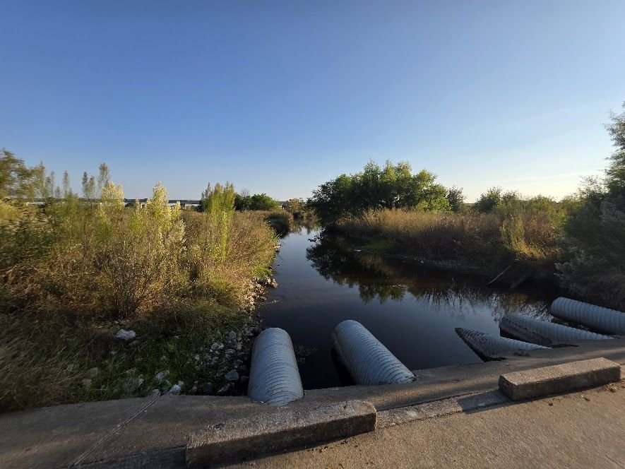
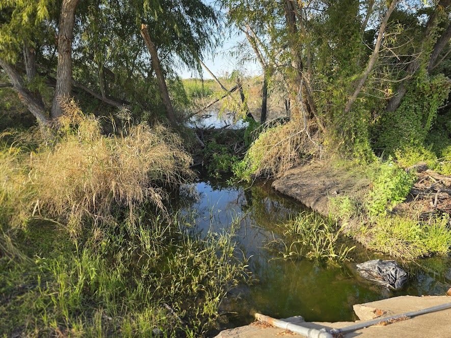
Overgrown drainage channel under a low concrete crossing.
Drainage channel, unmaintained.
Concrete culvert pipes at a creek crossing.
Culverts at a creek crossing.
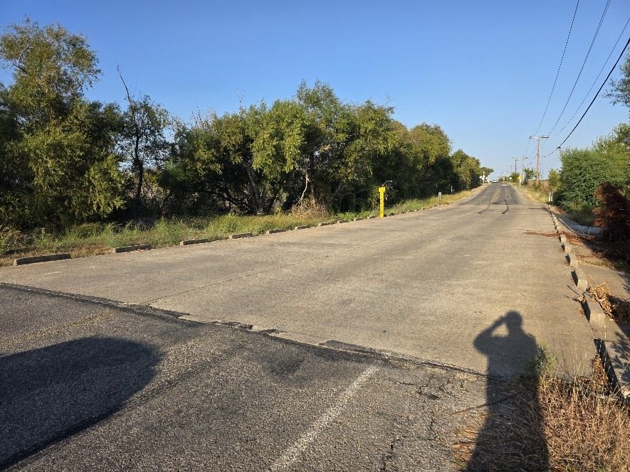
Rural two-lane road with no shoulders or sidewalks and overhead power lines.
Redwood Road: no shoulders or sidewalks.

Field photos from the study. Figures come from the cited studies, not new survey work.

Project
Community history & case study
Course
GEO 3301, Texas State
Date
Fall 2025
Role
Researcher, presenter

Spruce Street Infrastructure Inventory

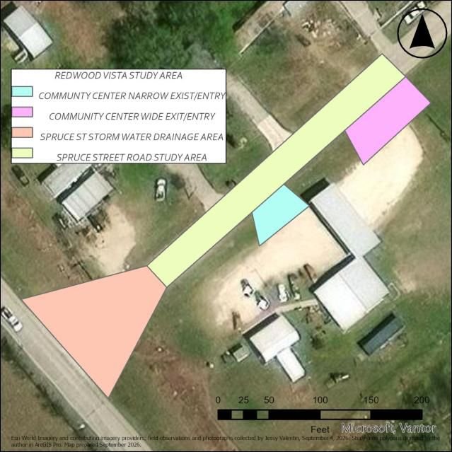
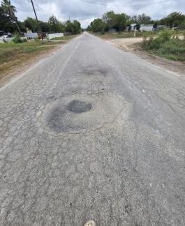
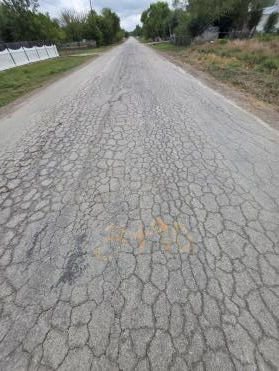
The county had repairs scheduled for Spruce Street, so this was a chance to record the street as it is before anything changes. The walk-through on September 4, 2026 followed the road from Redwood Road past the Centro Esperanza community center, photographing problems along the way and outlining the road, drainage and entrance areas on a GIS study-area map. The result is a short course memo, written in the format of a note to the county engineering department, that documents conditions before the repairs. It is student work and was not commissioned by the county.

WalkedSeen on the groundWhy it matters
RoadsAlligator cracking, patches and potholes; narrow shouldersNo sidewalks or crosswalks, so people walk in the lane
DrainageBrush and debris in the concrete drain pathsDrains need to stay clear for flood flows
UtilitiesLeaning poles, little street lighting, no hydrant nearbyNight safety and fire response
CommunityCommunity center with food distributions at the street entranceA main destination, reached without sidewalks
GIS study-area map over an aerial: the Spruce Street road study area, the storm water drainage area and the community center entrances.
Study-area map: road, drainage and entrance areas. Basemap © Esri and its data providers.
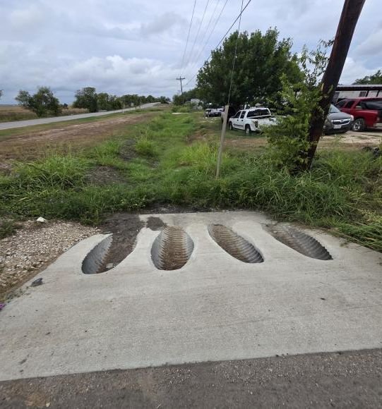
New concrete storm drain outlets under a driveway beside the road.
Storm drain outlets.
Pothole in the cracked asphalt of Spruce Street.
Surface pothole.
Alligator cracking across the Spruce Street pavement.
Pavement cracking.
Project
Infrastructure Inventory Memo
Location
Spruce St, Rancho Vista · San Marcos ETJ
Type
Student field memo, Texas State
Date
September 2026
Role
Field review, memo author
Tools
Field photosArcGIS Pro

Existing Homes, New Infrastructure

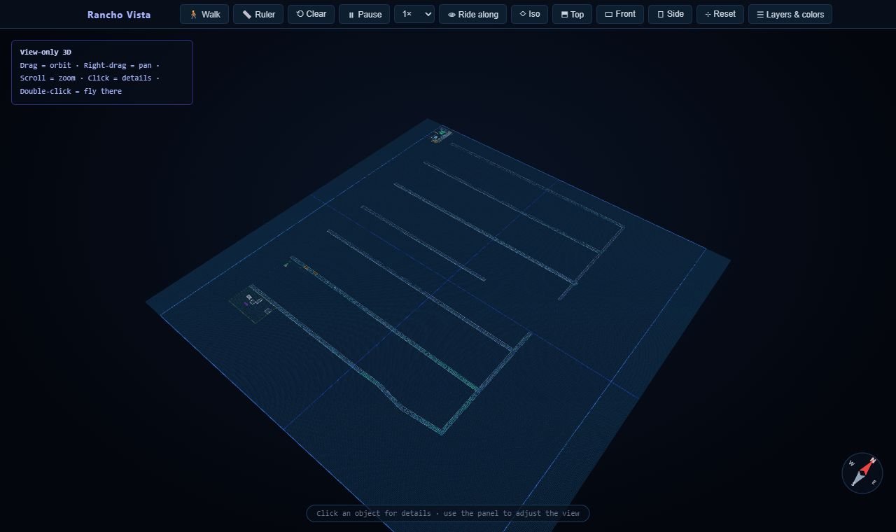
New subdivisions east of San Marcos are getting a regional wastewater plant, while the older homes next door still run on septic. This project asks a simple question: if Redwood and Rancho Vista were ever connected, where would the need be greatest, and which routes to new infrastructure would face the fewest obstacles from terrain, floodplain, roads and jurisdiction lines?

  • Mapping the regional water and wastewater picture within about 15 miles, from Martindale to Staples.
  • Reading the City's public plans for the new plant closely enough to separate what is planned for new development from what existing neighborhoods can actually expect.
  • Next: score existing parcels by need, then compare candidate connection routes in a 3D terrain model.
Preview of the interactive 3D model of the Rancho Vista street network.
Open full screen

Interactive model: the Rancho Vista street network traced over the subdivision plat in World Sim. Drag to orbit, scroll to zoom, click a street for details.

Project
Regional GIS Research Brief
Location
Redwood & Rancho Vista, near San Marcos
For
GIS final project, Texas State
Date
October 2026 In progress
Role
Researcher, GIS analyst
Tools
ArcGIS Pro3D terrainWorld Sim
Sources cited
  • City of San Marcos (2024), FM 1978 Water Reclamation Facility RFQ and basis of design.
  • Texas Commission on Environmental Quality, TPDES permit application WQ0015817001 (City of San Marcos).
  • City of San Marcos (2026), City Council Resolution 2026-121R.
  • 3DRancho Vista street model

Public meetings: budgets and roads

Following the Money and the Map

Two public meetings in September 2025, attended as a planning student and as a board member for Redwood and Rancho Vista. One decided what the City of San Marcos can pay for in the coming year; the other shapes where Guadalupe County roads can go for the next twenty.

San Marcos City Council · September 16, 2025

Fiscal year 2026 budget
$371.3Mbudget adopted, 7–0
65.15¢tax rate per $100 adopted, 5–2
What drove it
The city takes over EMS service in 2026, a new cost of about $2 million, and the sales tax meant to build that fund fell $863,000 short in 2023. Keeping the old 60.30¢ rate would have meant cuts on top of existing vacancies.
Where it stands
Council chose the break-even rate: it covers the budget with EMS included, but not the higher 67.69¢ rate that would have built a reserve over time. Water and wastewater rates were also amended, and an employee primary-care clinic contract was approved.
What to watch
Whether EMS costs come in near the estimate and whether the sales-tax shortfall continues, since a break-even budget leaves little room if either runs high.

Guadalupe County · September 23, 2025

Major Thoroughfare Plan open house
20 yrsplanning horizon
~4,000Redwood and Rancho Vista residents, estimated
What was raised
The draft maps did not clearly show Redwood and Rancho Vista and proposed no changes to their roads. Raised that with the consultants, discussed failing septic systems with the county's environmental health office, and left a written comment so the community is on the record.
Where it stands
The plan preserves right-of-way rather than building projects. Basic safety and durability work on existing roads in denser areas like Redwood would fit inside the current framework without restarting design or changing funding.
What to watch
The plan updates about every five years. Comment forms, emails and surveys are how needs get counted, so advocacy has to carry into each update.

Figures come from personal meeting notes. The City's adopted budget and the County's plan documents are the official record.

Project
Public meeting observation
Course
GEO 3320, Texas State
Date
September 2025
Role
Observer; public comment at the county meeting

Conference project: Plymouth Park, Irving

Plymouth Park Legacy Project

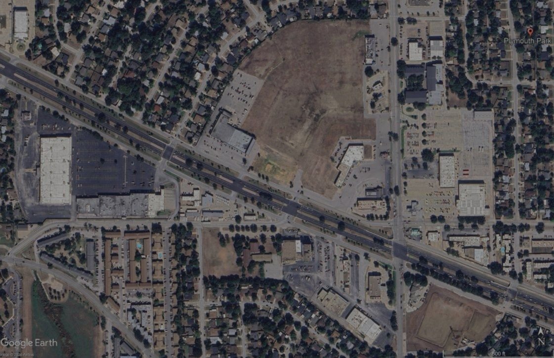
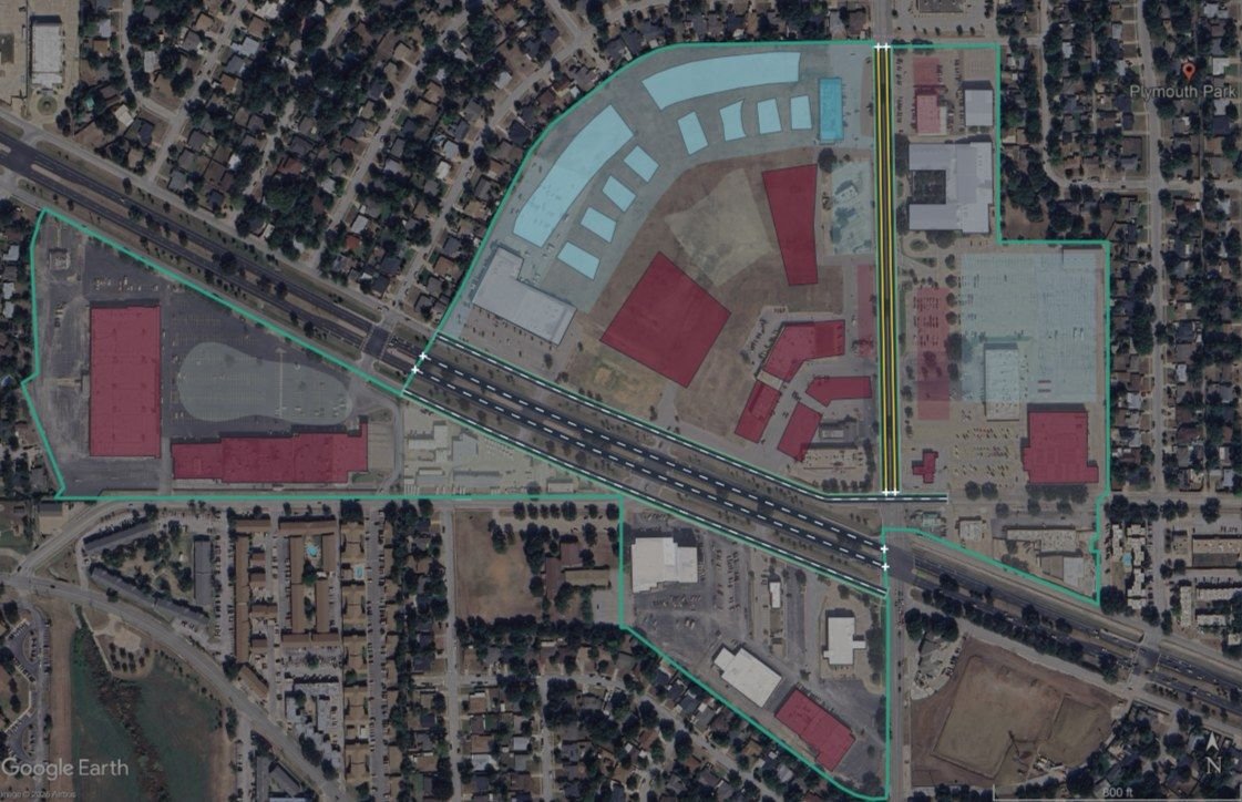
Student team project for the 2026 APA Texas Student Legacy Project, working from the City of Irving's brief. Team topic: governance, engagement and implementation. Role: website team, and modeling the site in World Sim from the team's master plan, first as an original concept and then as the final concept. The master plan itself is the work of the Plymouth Park student team.

1 · Today and the original concept
Aerial photo of the Plymouth Park site as it is today. The same aerial with the original concept modeled on it: study boundary, buildings, zones and roads. TodayOriginal concept Imagery © Google
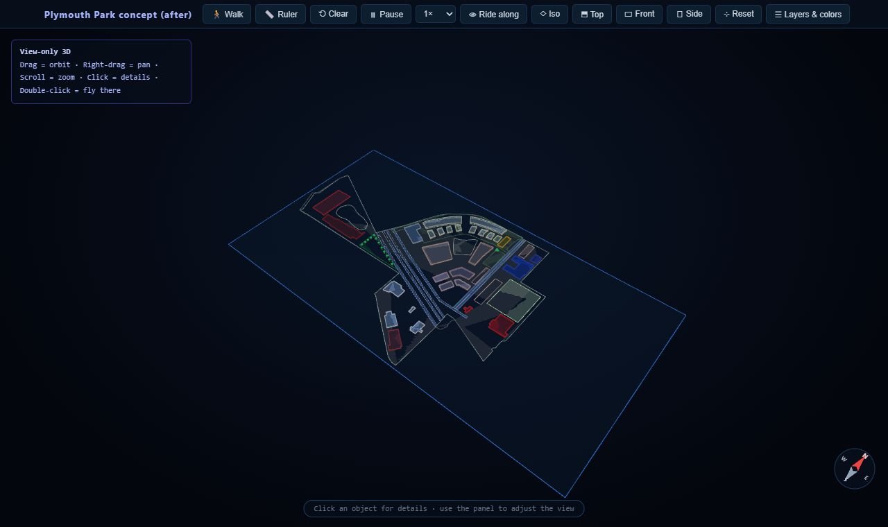
2 · Original concept in 3D
Preview of the interactive 3D model of the original Plymouth Park concept.
Open full screen

The first model, kept for comparison. About 2 MB.

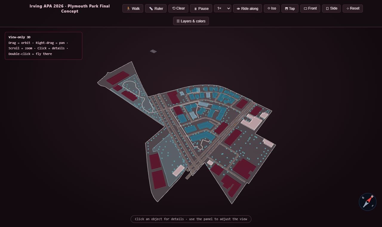
3 · Final concept in 3D
Preview of the interactive 3D model of the final Plymouth Park concept.
Open full screen

Buildings, open space and simulated traffic, modeled from the team master plan. About 16 MB, so it loads only when asked. Concept model, not surveyed.

Project
Plymouth Park, Irving
For
APA Texas Chapter, Student Legacy Project
Date
Fall 2026
Role
Website team; site modeling from the team master plan
Topic
Governance, engagement and implementation
Tools
World SimWeb design
Files & sources
  • 3DOriginal concept model
  • 3DFinal concept model
  • City of Irving and APA Texas Chapter (2026), Student Legacy Project brief, Plymouth Park.
  • Plymouth Park student team (2026), master plan. Team work, credited here; not reproduced.

From the job site: foundation work

Foundation Pier Layouts

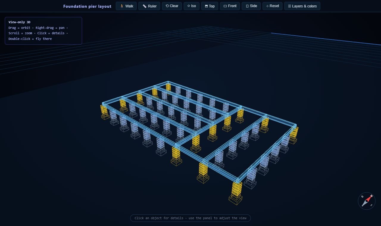
Six years of residential foundation repair build the same habits planning needs: reading soils, drainage and access, working through permits, and explaining the work to the people who live there. Each job moved from a field layout to an estimate, a permit packet and a work plan for the crew. Layouts are now modeled in 3D so owners can see the work before it starts.

Preview of the interactive 3D model: a pier and beam foundation layout.
Open full screen

Interactive model of a pier and beam layout: every beam bears on the pier caps. Click a pier or beam for its size.

  • 60 residential foundation projects coordinated from estimate to completion, 2018 to 2024
  • Site visits, contracts, permit applications and scheduling with civil engineers and field crews
  • Past job sites mapped in ArcGIS Pro with aerial imagery and terrain
Work
Foundation repair & site work
Company
All Tech Foundation Repair
Area
San Marcos and Central Texas
Date
2018 – 2024
Role
Foundation Project Manager
Tools
ArcGIS ProWorld Sim
Model
47piers on 24 in footings
11beams bearing on the caps
6 ftpier spacing along a beam
7.5 ftbetween beam lines

Policy and studio

Chapter 395 Impact Fee Policy Memo

A recommendation to the mayor and council of Clear Fork, a course case city, on water and wastewater impact fees under Texas Local Government Code Chapter 395. Recommendation: adopt fees at 75% of the modeled maximum, so new development helps pay for growth-related capacity while the fee stays below the ceiling.

2,095Water service units, 2026–2036
1,952.5Wastewater service units
$55.3MEligible project costs
$20.7MModeled fees at 75%

Figures come from the course dataset. The memo also flags the $6.9M left uncovered after credits and asks who would pay it.

Project
Infrastructure Politics Brief
Course
GEO 4356, Urban Infrastructure Management
Date
October 2026
Role
Analyst, memo author
Tools
ExcelPolicy writing

Sink Creek Site Assessment

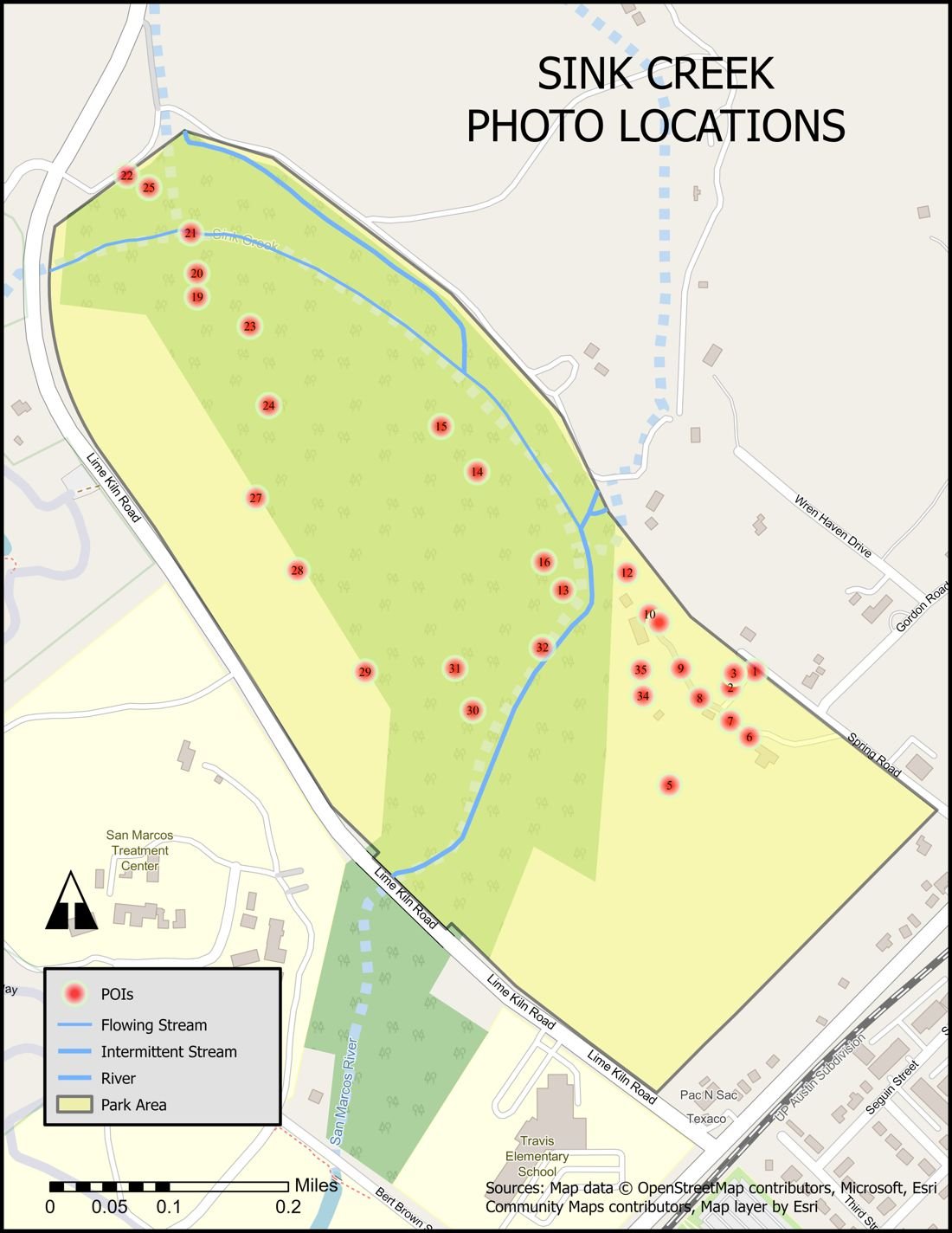
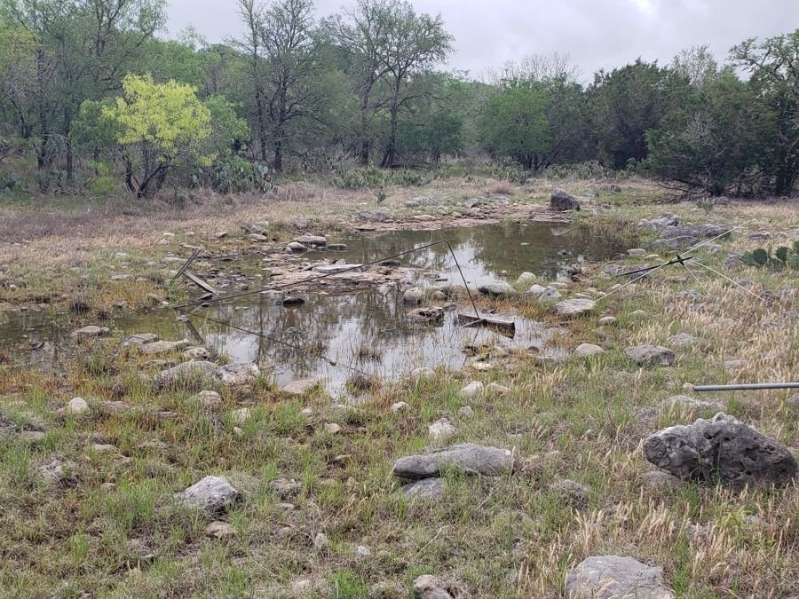
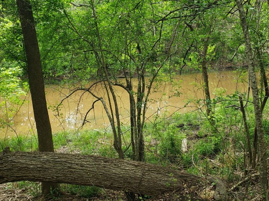
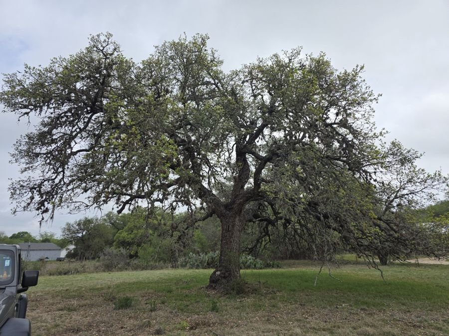
Capstone assessment of the Sink Creek property at the start of the San Marcos River. After a guided site tour, the team photographed 35 points across the property's ecological zones, mapped them in ArcGIS Pro, and presented their ecological value along with the water infrastructure on site.

Map of the Sink Creek property with the 35 photo locations marked.
Photo locations map by the capstone team. Basemap © OpenStreetMap contributors, Esri.
Shallow wetland pool among limestone rocks and grasses.
Wetland pool.
Sink Creek through the trees, with a fallen trunk in front.
Creek corridor.
Large live oak in an open grassy field.
Live oak savanna.
Project
Geography Capstone
Location
Sink Creek, San Marcos
Date
Spring 2026
Role
Team member, presenter
Tools
ArcGIS ProField survey
Field work
  • Photos35 photo points by the capstone team, site visit April 2026
  • MapPhoto locations over the property boundary, streams and road

ColLAB 2026 Planning Charrette

A hands-on workshop hosted by Texas A&M University and Texas Target Communities with planning students from Texas State, Texas A&M and other Texas universities. The team developed and presented strategies for neighborhood priorities in Greater Houston.

Project
ColLAB 2026
Date
February 2026
Role
Team member, presenter

Resume

  1. Aug 2026 – present

    Secretary

    Redwood Vista Water Supply Corporation

    Keep board records and meeting documentation. Coordinate communication among board members, residents and project partners, and support outreach on water and wastewater infrastructure.

  2. 2025 – present

    Event Security Staff

    5 Star Security

    Public-facing help at venues and festivals; answer questions and respond to incidents calmly with diverse crowds.

  3. 2022 – 2024

    General Contractor

    Idealistic Construction LLC

    Prepared bids and estimates; coordinated jobsite logistics, materials, equipment and safety with clients and contractors.

  4. 2018 – 2024

    Foundation Project Manager

    All Tech Foundation Repair

    Coordinated 60 residential foundation repair projects from estimate through completion: client communication, site visits, contracts, schedules, materials and inventory. Worked with civil engineers and field crews; supported payroll and bookkeeping.

Open to planning roles and internships

Let's talk about your community.

Based in San Marcos and available across Central Texas. Full memos, maps and a PDF resume are available on request.

Email (resume)
Jess.valtx@gmail.com
Location
San Marcos, Texas